January is where this story stops being abstract.
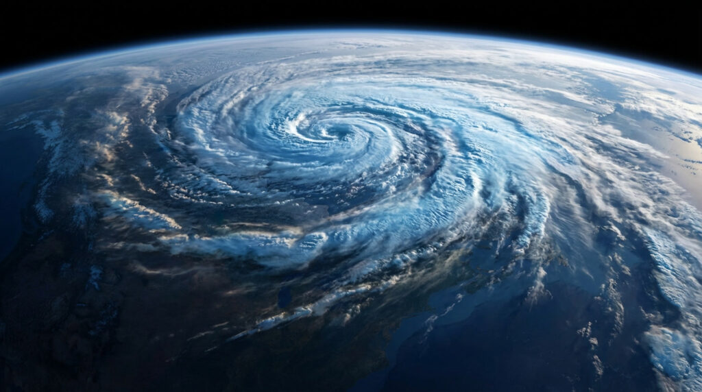
If the current polar vortex disruption fully propagates downward, the second half of January becomes the danger zone. That’s typically when stratospheric chaos translates into surface-level consequences: stubborn high-pressure blocks, a kinked jet stream, and cold air that refuses to stay polite and north of the Arctic Circle.

For parts of North America, that could mean deeper, longer cold spells rather than quick shots of chill. The kind that stick around for days, sometimes weeks, stressing heating systems and power grids more than a single dramatic snowstorm ever could. The Midwest and Northeast often feel these patterns first, but southern regions aren’t immune—especially when Arctic air spills farther south than infrastructure expects.
Read Also- Social Security Beneficiaries to See Bigger Checks Thanks to 2 Major Tax Changes
In Europe, January disruptions often show up as blocking over Greenland or Scandinavia. That setup can funnel bitter easterly winds into northern and western Europe, while southern regions swing between cold snaps and stormy, unsettled weather. Snowfall risks rise not just from cold air, but from clashes between Arctic intrusions and moisture-rich Atlantic systems.

For Asia, especially Siberia and parts of East Asia, a weakened vortex can intensify already harsh winter patterns. January cold outbreaks there can be severe, with impacts on energy demand, transportation, and air quality.
The key thing meteorologists keep stressing is persistence. January cold linked to a disrupted vortex is less about headline-grabbing single days and more about repetition. Cold that retreats briefly, then comes back. Snow that melts just enough to refreeze. Storm tracks that stall instead of moving on.
That’s why January planning matters more than December nerves. By the time the calendar flips, the atmospheric dice may already be loaded.
How to think about January forecasts without losing your mind

January forecasts will swing. That’s normal. One model run will scream “historic cold,” the next will back off. The signal to watch isn’t individual maps, but patterns repeating across multiple days and models.
Smart January mindset:
- Treat extended cold as a scenario, not a certainty
- Watch for blocking patterns mentioned repeatedly by forecasters
- Pay attention to overnight lows more than daytime highs
- Prepare for infrastructure stress, not just snow totals
- Expect impacts to evolve over weeks, not hours
As one U.S. forecaster put it bluntly: “January after a stratospheric disruption is less like flipping a switch and more like slowly turning a dial.”
Why January is the month that tests systems, not just patience
December cold is often manageable. January cold exposes weaknesses.
Pipes freeze. Batteries die faster. Roads degrade under repeated freeze-thaw cycles. Emergency services feel the strain when cold lingers instead of passing through. That’s why utilities, city planners, and emergency managers are watching this setup closely, even while public messaging stays cautious.
For households, January is when small preparations pay off. Extra blankets suddenly matter. A backup heat source becomes more than a theoretical idea. That charger you never use? You’ll be glad it’s full.
And emotionally, January is already a heavy month. Add prolonged cold, and the mental load increases. That’s another reason meteorologists are trying to communicate risk rather than panic. The goal isn’t fear. It’s readiness.
If this polar vortex disruption fades, January may pass quietly, remembered only by weather nerds. If it doesn’t, January could remind a lot of people that winter still has teeth—especially when the atmosphere decides to rearrange itself above our heads.
Either way, the smart move is the same: watch closely, prepare calmly, and don’t wait for certainty before taking simple precautions. Winter doesn’t need permission to surprise us.
FAQs:
What is a polar vortex disruption?
A polar vortex disruption happens when strong waves from the lower atmosphere warm the stratosphere above the Arctic, weakening or distorting the vortex that usually keeps cold air locked near the pole.
Does a December disruption automatically mean a brutal January?
No. It increases the chance of colder, more unstable winter weather, but the exact impacts depend on how the jet stream and surface pressure patterns evolve in the following weeks.
When would surface impacts be most likely?
Typically 1–3 weeks after the main stratospheric disruption, which puts late December through January in the highest-risk window.